
Scott International Procedures
April 1, 2026
4.3+
The Red Toolbox menu on the Scott Plot® chart screen contains the app's in-flight tools. Each tool is covered in its own article, listed below in the order they appear in the menu.
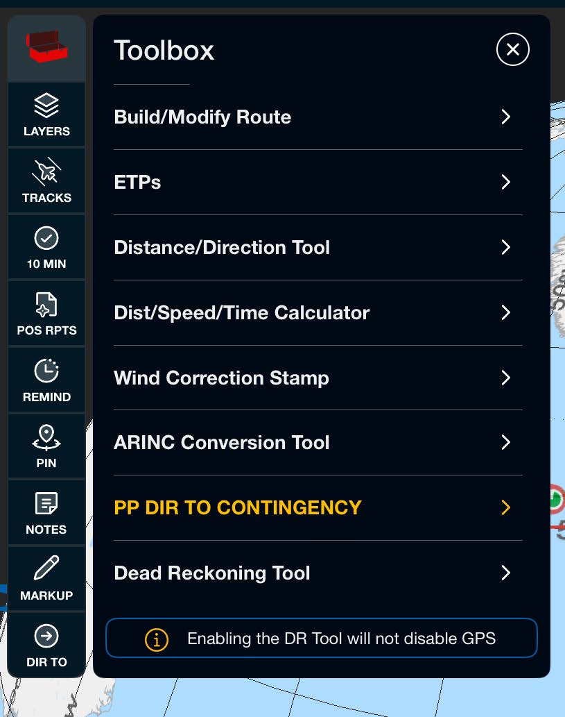
Post a route from your flight plan, then enter, edit, or drag-and-drop it on the chart. Full steps are in Build / Modify Routes and Drag & Drop Route Editing under Routes & Navigation.
Note: If no route is displayed with a popup, ensure that a flight plan is selected on the Preflight Wizard. It is recommended that you build a trip from your flight plan using the Preflight Wizard.
Edit already-constructed ETPs and add new ones by entering lat/long values from your flight plan. See ETPs by Lat/Long from Flight Plan.
Have the app calculate an Equal Time Point from wind and true airspeed you enter, for use only when flight plan ETPs are unavailable. See Calculate New ETP.
Measure the distance and course between any two points on the chart. See Distance and Direction Tool.
Enter any two of distance, speed, or time and the calculator returns the third instantly. See Dist/Speed/Time Calculator.
Post a wind drift correction value and direction to the chart, and delete the stamp when it no longer applies. See Wind Correction Stamp.
Convert between latitude/longitude coordinates and ARINC 424 waypoint formats directly from the plotting chart. See ARINC Conversion Tool.
Plot a great circle route from your present position, or a location you enter, direct to a destination for situational awareness. See PP DIR TO Contingency.
Dead Reckoning provides timing and position estimation for contingencies and training, with leg-by-leg setup and a DR log for the Journey Logbook. Full guidance is in Dead Reckoning under Routes & Navigation.

Scott International Procedures, LLC.
Colorado, USA


© 2026 Scott International Procedures, LLC. All rights reserved.
Because safety is in the details™